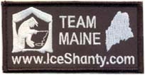
Author Topic: fishing app  (Read 1461 times)

Offline NENEchirodoc

  • IceShanty Rookie
  • **
  • Posts: 45
fishing app
« on: Jan 07, 2015, 09:15 PM »
Just curious what the best smart phone app is for lake maps and contours?  Would be nice to have one that doesn't necessarily require service since most of the lakes I fish are cell phone dead zones.  TIA

Offline Martinezb9

  • Team IceShanty Regular
  • ***
  • Posts: 103
Re: fishing app
« Reply #1 on: Jan 07, 2015, 09:17 PM »
Arcgis and navionics

Offline Slabsticker

  • IceShanty Rookie
  • **
  • Posts: 66
Re: fishing app
« Reply #2 on: Jan 07, 2015, 09:53 PM »
Navionics!

Offline eepks

  • Team IceShanty Regular
  • ***
  • Posts: 362
Re: fishing app
« Reply #3 on: Jan 07, 2015, 10:04 PM »
They have the Nebraska lakes, big and small?

Offline Derag2

  • Team IceShanty Regular
  • ***
  • Posts: 111
Re: fishing app
« Reply #4 on: Jan 07, 2015, 10:32 PM »
I can't get arcgis to show topography maps anymore.....  did they change it? Seems like just a map and no options for layers.

Offline Callahan21

  • IceShanty Rookie
  • **
  • Posts: 6
Re: fishing app
« Reply #5 on: Jan 07, 2015, 10:39 PM »
I used ArcGIS last Saturday and it worked great for us. Seems like I had to zoom in a long way to get the contours but our GPS location and depth was dead on.

Offline CatskillsFisher

  • Team IceShanty Regular
  • ***
  • Posts: 269
Re: fishing app
« Reply #6 on: Jan 07, 2015, 10:44 PM »
Navionics app treats me well.

Offline problyfishin

  • Team IceShanty Regular
  • ***
  • Posts: 164
Re: fishing app
« Reply #7 on: Jan 08, 2015, 12:53 AM »
OnXHunt. This is a better hunting app but I've notice it has all topo too. If you are a hunter too this is an awesome duel purpose app. It's a bit pricey but i absolutely love it. Provides parcel info for nearly the entire state. 7 day free trial. Check it out!

Offline NENEchirodoc

  • IceShanty Rookie
  • **
  • Posts: 45
Re: fishing app
« Reply #8 on: Jan 08, 2015, 07:11 AM »
When I go to the app store and search navionics, all these boating apps come up...which one do I choose?

Offline Tikkaman

  • Team IceShanty Regular
  • ***
  • Posts: 230
Re: fishing app
« Reply #9 on: Jan 08, 2015, 07:15 AM »
Boating USA avionics app is great tool

Offline Tikkaman

  • Team IceShanty Regular
  • ***
  • Posts: 230
Re: fishing app
« Reply #10 on: Jan 08, 2015, 07:16 AM »
When I go to the app store and search navionics, all these boating apps come up...which one do I choose?

It's the $10 one

Offline shake

  • Team IceShanty Regular
  • ***
  • Posts: 224
Re: fishing app
« Reply #11 on: Jan 08, 2015, 07:17 AM »

Offline Flatrocker

  • IceShanty Rookie
  • **
  • Posts: 81
Re: fishing app
« Reply #12 on: Jan 08, 2015, 07:52 AM »
If any of you were going to use a GPS unit instead phone apps, would one would you chose for maps on the ice?

Offline FishGut

  • Team IceShanty Addict
  • *
  • Posts: 918
Re: fishing app
« Reply #13 on: Jan 08, 2015, 08:00 AM »
The Navionics app doesn't have current contours on very many Nebraska lakes. It may be great for other states, but not here. The lakes that I fish on the east side of the state either do not have depth maps at all, or the Navionics map is based on surveys from before Y2K.

I think you're best served by the ArcGIS app and maps provided by the state, both for hunting and fishing. It's free too.
Nebraska certified Fishing Instructor

Offline Derag2

  • Team IceShanty Regular
  • ***
  • Posts: 111
Re: fishing app
« Reply #14 on: Jan 08, 2015, 11:03 AM »
I zoomed in all the water on the lake and I'm not getting anything.....  I don't get the options for the different overlays either..  like satellite views and what not

Offline openwaterguy

  • IceShanty Rookie
  • **
  • Posts: 19
Re: fishing app
« Reply #15 on: Jan 08, 2015, 11:23 AM »
Following.....I can't see any detailed contours on either App. I'm thinking only big lakes will have the detailed layout.

Offline 15inches

  • IceShanty Rookie
  • **
  • Posts: 23
Re: fishing app
« Reply #16 on: Jan 08, 2015, 11:24 AM »
I use Trimble Fish App. It is also free and does what I need. Good GPS some lakes have contours some don't. I'm guessing many smaller lakes have not been mapped yet.
"Anyone can be a fisherman in May"
                    - Ernest Hemingway

Offline mvanhank222

  • Team IceShanty Regular
  • ***
  • Posts: 268
Re: fishing app
« Reply #17 on: Jan 08, 2015, 11:25 AM »
did you select sonar maps in the bottom left corner?

Offline openwaterguy

  • IceShanty Rookie
  • **
  • Posts: 19
Re: fishing app
« Reply #18 on: Jan 08, 2015, 11:28 AM »
Can someone inform me if it is true that the Nebraska game and parks have detailed maps(contours) of all public lakes(big&small)?

Offline FishGut

  • Team IceShanty Addict
  • *
  • Posts: 918
Re: fishing app
« Reply #19 on: Jan 08, 2015, 01:32 PM »
Not quite ALL the lakes in the state, but most of the good ones. And new lakes are being added all the time. Here's the link to the Game and Parks web site with the lake maps. Click on the part of the state you are interested in, then you'll get a list of maps you can print off. Every one of those maps is also available on the ArcGIS app from the NGPC as well.

Nebraska Game and Parks Lake Mapping program: http://outdoornebraska.ne.gov/fishing/programs/lakemapping/lakemapping.asp
Nebraska certified Fishing Instructor

Offline openwaterguy

  • IceShanty Rookie
  • **
  • Posts: 19
Re: fishing app
« Reply #20 on: Jan 08, 2015, 02:45 PM »
Wow! Thank you very much Fishgut! Just what I was in need of!!

Offline HntFsh

  • IceShanty Rookie
  • **
  • Posts: 30
Re: fishing app
« Reply #21 on: Jan 08, 2015, 04:59 PM »
On ArcGIS I searched for "Nebraska Lakes" to find the contour maps. Then I saved it to favorites.

Offline FishGut

  • Team IceShanty Addict
  • *
  • Posts: 918
Re: fishing app
« Reply #22 on: Jan 08, 2015, 09:06 PM »
This a quick tutorial I put together for another forum on finding Nebraska Game and Parks stuff on your ArcGIS download:


Download the free ArcGIS app from your app store

Search Nebraska Game and Parks

Make sure you hit the "More Results" button at the bottom of the selections, so you can get to the Lake Contour Maps.

Click that, and you're good to go.

Add that map to your "favorites" so you can access it later, if you also add the Public Access Atlas (for Open Fields and Waters properties). Then you can switch between those two types of maps by clicking on the map and magnifying glass icon at the top left side of the screen. You can also add trails maps, Loin Sightings, and a host of other maps the NGPC provides.
Nebraska certified Fishing Instructor


Iceshanty | MyFishFinder | MyHuntingForum
Contact | Disclaimer | Privacypolicy | Sponsor
© 1996- Iceshanty.com
All Rights Reserved.